Chiricahua National Park: The Senior Visitor's First Guide to America's 64th Park
On October 20, 2026, Chiricahua National Monument became Chiricahua National Park — the first new U.S. national park in six years. Here is the accessibility-first visitor guide nobody has written: the scenic drive, trails honestly rated for 50+ knees, wildlife, Willcox lodging, and the one caveat you must read before you go.
⚡ Key Takeaways
- Designated October 20, 2026 — 64th U.S. national park, 4th in Arizona, first new park in six years.
- Best experience for 50+: the 8-mile Bonita Canyon Scenic Drive to Massai Point — the "wonderland of rocks" from your car.
- Trails: short walks near Echo Canyon for easy days; the 3.4-mile Echo Canyon Loop is moderate but has steep drop-offs — ask a ranger first.
- Wildlife: coatimundi, javelina, and some of the Southwest's best birding.
- Base: Willcox, ~36 miles north — small-town lodging, wine, and birding seasons.
- ⚠️ Read the caveat: NPS maintenance projects at Chiricahua have been ranked "low priority" amid federal workforce cuts — verify facility status before you go (details below).
The Designation: What Changed on October 20
For over a century, this corner of southeastern Arizona was Chiricahua National Monument — protected since 1924, when President Calvin Coolidge set it aside under the Antiquities Act (President Franklin D. Roosevelt expanded it in 1938). The new law changes the designation, not the land: the park keeps its existing boundaries (~12,000 acres, about 19 square miles), its roads and trails, its campground, and its federal management. The law also preserves tribal access for traditional Chiricahua Apache ceremonies, including provisions for temporary closures to protect cultural uses — the land is part of the historical territory of the Chiricahua Apache, who called these formations the "Land of Standing-Up Rocks."
The push was bipartisan and years in the making: Senators Mark Kelly and Ruben Gallego carried the Senate companion bill, while Representatives Juan Ciscomani and Greg Stanton guided it through the House. Earlier efforts had stalled repeatedly since 2016. For visitors, the practical effect is familiar from other monument-to-park upgrades: the same experience, under a bigger spotlight — and, historically, roughly 20 percent more visitation, according to Willcox mayor Greg Hancock.
Getting There
Chiricahua sits in Cochise County, southeastern Arizona, in the Chiricahua Mountains — about 120 miles southeast of Tucson (roughly a two-hour drive) and near the New Mexico border. The gateway town is Willcox, about 36 miles north of the park entrance, and the nearest major airport is Tucson International (TUS).
The drive from Tucson is straightforward desert highway, and the final approach climbs into the mountains — take it slowly, fill up in Willcox (services inside the park are minimal), and arrive with daylight to spare if you're unfamiliar with mountain roads.
The Scenic Drive: The Headline Experience for 50+
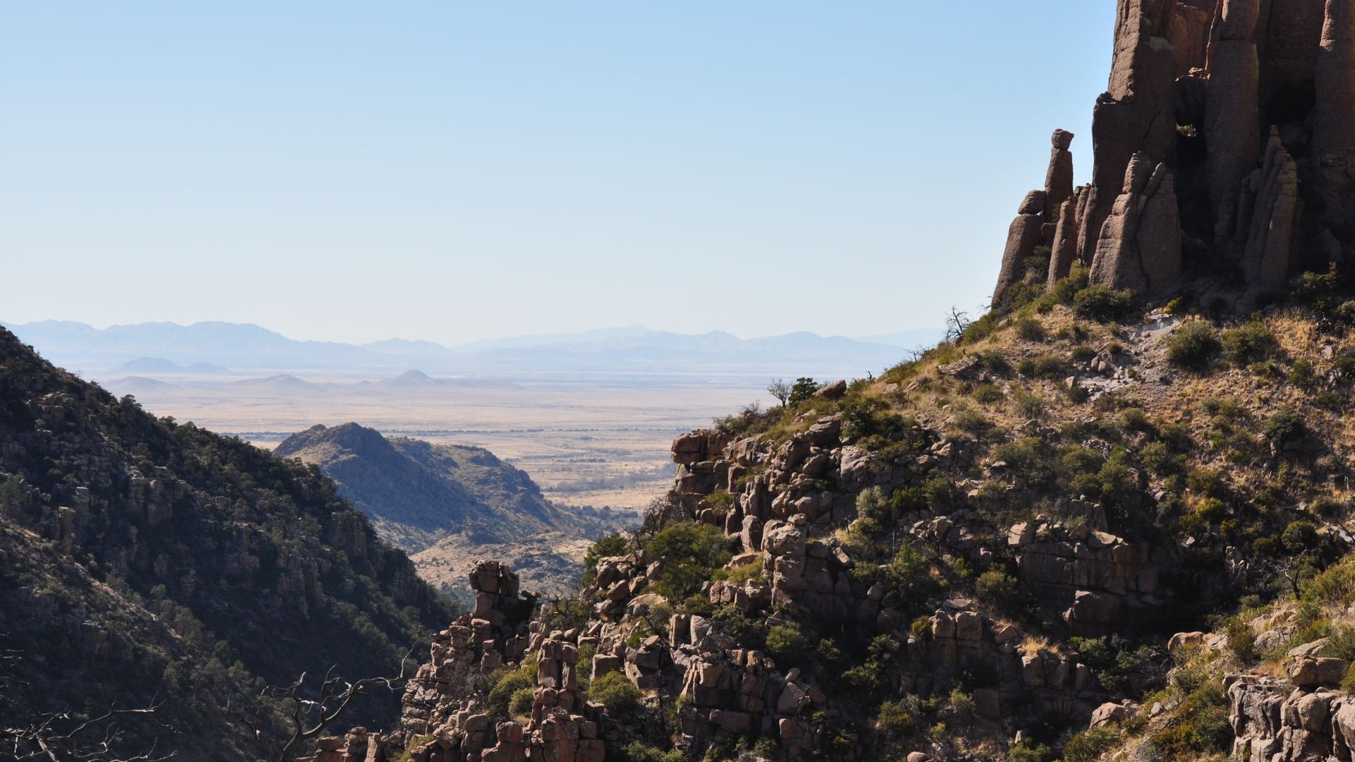
If you do one thing at Chiricahua, make it the Bonita Canyon Scenic Drive: an 8-mile paved road that winds from the visitor center through the heart of the rock formations to Massai Point, the park's signature overlook. This is the accessibility-first way to experience the park — the famous "wonderland of rocks" unfolds outside your windshield, with pullouts and short, flat overlooks along the way.
What you're looking at: some 27 million years ago, the Turkey Creek Volcano erupted and blanketed the region in ash over a thousand square miles. The ash fused into layers of rhyolite tuff, and millions of years of wind and water erosion carved away the softer rock — leaving the stacked pinnacles, balanced rocks, and hoodoos you see today. Early settlers called it the "Wonderland of Rocks"; the geology is the whole show, and the drive puts you in the middle of it.
Trails, Honestly Rated for 50+
Chiricahua's trail network winds through the formations, but this is rugged terrain — loose rock, uneven footing, and real elevation. Here's an honest tiering, with distances from recent trail reporting:
| Tier | Trail / area | Distance & effort | 50+ verdict |
|---|---|---|---|
| 🟢 Easy | Echo Canyon parking-area walks (e.g., first mile of the Echo Canyon Trail past the Grottoes) | ~1 mile out-and-back, gentle | Top pick for 50+. You walk among the pinnacles with minimal climbing — the highest reward per step in the park. |
| 🟡 Moderate | Echo Canyon Loop | 3.4 miles, ~560 ft elevation gain | Doable if you're steady on your feet — but the trail has steep drop-offs on loose, uneven rock. Ask a ranger about current conditions before committing. |
| 🟡 Moderate | Echo Canyon to Visitor Center | 4.2 miles one way, ~1,000 ft gain (downhill if started at Echo Canyon) | One-way option with a seasonal shuttle back — but confirm the shuttle is running; don't assume. |
| 🔴 Hard | Natural Bridge Trail | 4.7 miles, ~1,000 ft gain | Skip unless you're a fit, experienced hiker. Impressive formation, demanding trail. |
Also worth knowing: Faraway Ranch, the historic pioneer homestead in the park, offers guided tours and interpretive programs — a low-exertion cultural stop that breaks up a driving day. The ranch was established in the late 19th century by Swedish immigrants Neil and Emma Erickson.
Wildlife Watching: Coatimundi Country
Chiricahua is a biodiversity hotspot where desert, grassland, and mountain ecosystems collide. The signature animal is the coatimundi — a raccoon relative with a long snout and ringed tail that troops through the canyons in bands. You're also likely to see javelina, Coues white-tailed deer, and, if you're lucky, a troop of coatimundi at dawn or dusk.
Birders, take note: the Chiricahuas are legendary in birding circles, and Willcox's birding seasons are a point of local pride — elegant trogons, hummingbirds, and Mexican species at the northern edge of their range. Bring binoculars; the scenic drive pullouts double as birding stops.
Where to Stay: Willcox as Base
Willcox (~36 miles north) is the natural base: motels, restaurants, gas, and groceries, plus a wine-tasting scene and the birding culture mentioned above. Book ahead in spring and fall — the designation bump in visitation will hit small-town lodging first.
Inside the park, the 25-site campground suits tents and truck campers; reserve on Recreation.gov. Larger RVs and trailers should use private campgrounds near Willcox instead — the park campground's tight turns among the rocks are not built for big rigs.
Flying in? Our holiday airfare guide explains why booking flights early matters right now, and our jet-fuel fare outlook covers what rising fuel costs mean for 2027 trip budgets. Tucson pairs well with a southern-Arizona loop — see our Santa Fe senior guide for another Southwest favorite.
When to Go
Spring (April–May) and fall (October–November) are the classic windows: mild days, clear skies, wildflowers in spring and golden color in fall. Summer brings monsoon-season afternoon thunderstorms and heat — dramatic skies, but plan hikes for early morning. Winter can be cool at elevation, with occasional snow dusting the pinnacles (beautiful, but check road conditions).
⚠️ The Honest Caveat: Verify Before You Go
Here's what the celebration coverage doesn't emphasize: reporting on the designation notes that maintenance projects at many National Park Service sites — including Chiricahua — have been ranked "low priority" amid federal workforce cuts, with attention instead going to high-profile projects elsewhere. The designation law does not guarantee new facilities, more parking, expanded services, or additional staffing — those depend on future appropriations and management decisions.
What this means for your trip planning:
- Check the NPS Chiricahua conditions page before you go — road status, trail closures, visitor-center hours, and campground availability.
- Don't assume the seasonal shuttle is running — confirm directly if your hiking plan depends on it.
- Expect the name change to outpace the infrastructure — more visitors, same facilities, at least in the near term. Arrive early in the day for parking at popular trailheads.
- Carry a paper map or downloaded offline map — cell service in the mountains is unreliable, and a short-staffed park means fewer rangers to ask.
Frequently Asked Questions
When did Chiricahua become a national park?
On October 20, 2026, President Trump signed the Chiricahua National Park Act into law, redesignating the longtime Chiricahua National Monument (established 1924) as America's 64th national park and Arizona's fourth, alongside the Grand Canyon, Petrified Forest, and Saguaro. The Senate passed the bill on September 30, 2026. It is the first new U.S. national park in six years.
What is the best way for older visitors to see Chiricahua?
The Bonita Canyon Scenic Drive is the headline experience for visitors 50+: an 8-mile paved road winding through the heart of the rock formations to Massai Point, the park's signature drive-up viewpoint. You can see the famous "wonderland of rocks" from your car and from short, flat overlooks — no hiking required.
Which trails are best for travelers 50+?
Start with the short walks near the Echo Canyon parking area, such as the first mile of the Echo Canyon Trail past the Grottoes. The full Echo Canyon Loop (3.4 miles, 560 feet of elevation gain) is moderate but has steep drop-offs and loose, uneven rock — ask a ranger whether it suits your mobility. The 4.7-mile Natural Bridge Trail (1,000 feet of gain) is better left to fit hikers. Always check current trail conditions at the visitor center.
Where should I stay near Chiricahua National Park?
Willcox, about 36 miles north, is the natural base — a small town built on tourism, wine, and bird-watching seasons. The park's own 25-site campground suits tents and truck campers (reserve on Recreation.gov); larger RVs should use private campgrounds near Willcox. Expect busier lodging than in the monument years: towns transitioning to national-park status have historically seen roughly 20 percent more visitation.
When is the best time to visit Chiricahua?
Spring (April–May) and fall (October–November) are the classic windows — mild temperatures and clear skies. Summer brings monsoon-season afternoon storms and heat; winter can be cool at elevation. Check the National Park Service's current conditions page before any trip, especially after the designation, as staffing and maintenance schedules are in flux.
Is the park affected by National Park Service budget cuts?
Yes, potentially. Reporting on the designation notes that maintenance projects at many NPS sites — including Chiricahua — have been ranked "low priority" amid federal workforce cuts. The designation law keeps the park's boundaries, roads, trails, and campground the same for now, but it does not guarantee new facilities or staffing. Verify facility status, road conditions, and visitor-center hours on the NPS website before visiting.
🏜️ Planning a Southwest Trip?
Chiricahua pairs beautifully with Saguaro, Tucson, and Santa Fe. Browse our senior-travel guides before you book — and check NPS conditions before you go.
Browse Travel Guides →